Back Home in Tucson
It's Monday afternoon in Tucson and our short trip ended on Saturday evening--but I am just getting back to the blog. I hope I can cover the highlights of the trip, with photos--in one or two blog entries.
Friday, 2 November 2018
Phoenix to Sedona
After spending Thursday night at the Hilton Garden Inn Phoenix Airpot North--quite a mouthful--Will and I pick up Lisa and Mike at PHX shortly after 9am on Friday morning. Their non-stop flight from Detroit lands a few minutes early and we are able to retrieve their luggage and be on the road north before 10am. We have to drive through central Phoenix on Interstates 10 West and 17 North to escape the hubbub and traffic. After about an hour we are in the northern suburb of Anthem, with about 90 minutes to go to reach Sedona, our first stop. The countryside is dotted with hills and low mountains and lots of wide green space--so much space that the northbound and southbound lanes of I 17 are spread wide apart. The ride is quite scenic as we climb up to 4000 feet and the vegetation changes from desert cactus to grassland scrub. Saguaro cactus--the signature plant of southern Arizona--reaches its northern growth limit just as we leave Phoenix.
Just south of Sedona, on SR 89A, a scenic highway, we stop at a Visitor Center for our first views of Red Rock Country, the primary geological characteristic of this part of Arizona.
It's time for lunch and Sedona's Main Street is a good place to stop, with a wide selection of cuisines from which to choose, as well as a wonderful fudge shop for dessert. We are happy with hamburgers and pulled-pork sandwiches and a short walk.
 |
| Will, Lisa, and Mike |
 |
| Sedona's Outdoor Artworks |
 |
| Sedona: Red Rocks, Restaurants, and Hotels |
 |
| Sedona Shopping |
We are then ready to continue north on 89A into Oak Creek Canyon. As we start the climb into and upward out of the Canyon, the scenery changes dramatically from dry desert scrub to tall pine trees and a flowing creek. The blinding sunshine of Sedona and the desert gives way to the cool shade of the valley trees. All along the creek bed are small hotels and resorts, as well as rental cabins--very popular from spring through fall.
We exit Oak Creek Canyon and rejoin the freeway just a few miles south of Flagstaff, the major population hub of northern Arizona, home to its tallest mountain, Humphreys Peak (14,633 feet), its top covered with ice and snow, even this early in November.
The 90-minute route from Flagstaff to the Grand Canyon covers a pleasant, if ordinary, swath of northern Arizona, with landscape more like central Pennsylvania or upstate New York, than what is "typical" Arizona. We head west from Flagstaff to Williams on I-40 and then turn north on SR 64. This highway lies flat and straight atop the Kaibab Plateau, and gives no hint of the scenic wonders to come at the end of the road. In less than an hour we pass through the village of Tusayan, where we will be spending the night. But it's nearing 4pm and we want to give Lisa and Mike their first-ever view of the Canyon before it gets dark.
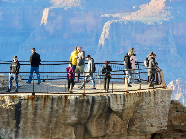
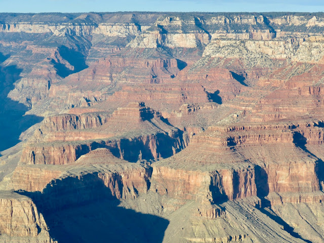
We drive through the park gatehouse waving our Golden Age pass--good for the whole carload--which allows us free entry to the park as many times as we like. In 10 more minutes we are at the Visitor Center in Grand Canyon Village, directly adjacent to Mathers Point with its majestic view of the Canyon. It's quite cool and the wind is starting to blow, but nothing can diminish the glory of these first few minutes overlooking the Grand Canyon in its splendor. At this time of day the colors are muted to pastel, but we can still spot the blue of the Colorado River snaking its way west and southward through the canyon, still digging deeper and carving out more layers of color and shape.
 |
| Mathers Point |
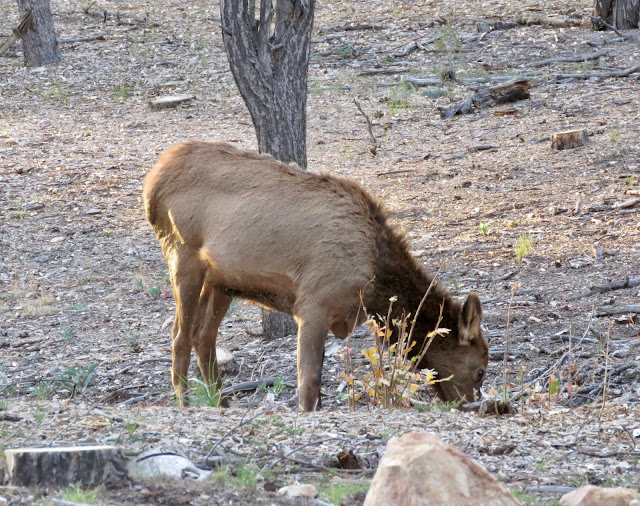
It's been a long day of driving and flying (for Lisa and Mike), so we are soon ready to head back to Tusayan to find the Grand Canyon Plaza Hotel, passing a few local denizens as they are foraging for dinner. The next blog entry will begin with Saturday morning at the canyon.


__03.jpg)